I-10 - Land For Rent
Desert Center, CA 92239 |
I-10
Desert Center, CA 92239
OVERVIEW
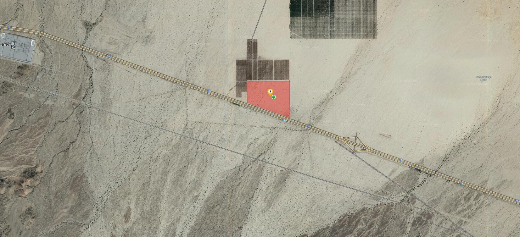
APN: 811-231-007, 113.72 Acres; Corn Springs Exit. Visible from the I-10.
Near the Maverick Solar Energy Project and the SCE Red Bluff Sub-Station.
ZONING: W-2-10, Chuckwalla Area GENERAL PLAN: OS-RUR (Open Space Rural)
NO AG PRESERVE, NO FLOOD PLAIN, NO MULTI SPECIES HABITAT CONSERVATION PLAN (MHSCP) Terms: Ground Lease Only- 10-15 year minimum
Directions: Take 1-10 East past Chiraico Summit, property is on the north side of the I-10 Freeway.
Google Maps: https://www.google.com/maps/@33.6869438,-115.2577912,3a,73.7y,345.36h,91.05t/data=!3m6!1e1!3m4!1s5AfhuLmC20Zw_0qDSgcO7Q!2e0!7i16384!8i8192
FOR LEASE DETAILS
PRICE
-
# OF LOTS
-
LAND DETAILS
PROPERTY NAME
113.72 A. Corn Springs Exit/ I-10 Freeway
PROPERTY TYPE
Land
PROPERTY SUBTYPE
Commercial
LAND PROPOSED USE
Commercial, Industrial, Mixed Use, Contractor Storage Yard, Radio/TV Transmn Facility, Utility Sub-Station, Agricultural
LAND ACRES
-
LAND SF
-
OFFSITE IMPROVEMENTS
-
ZONING
-
APN/PARCEL ID
811-231-007


