Common Ln - Commercial LAND FOR SALE
Knottingley, WYK WF11 8BN | 2,308,680 SF

Common Ln
Knottingley, WYK WF11 8BN
OVERVIEW
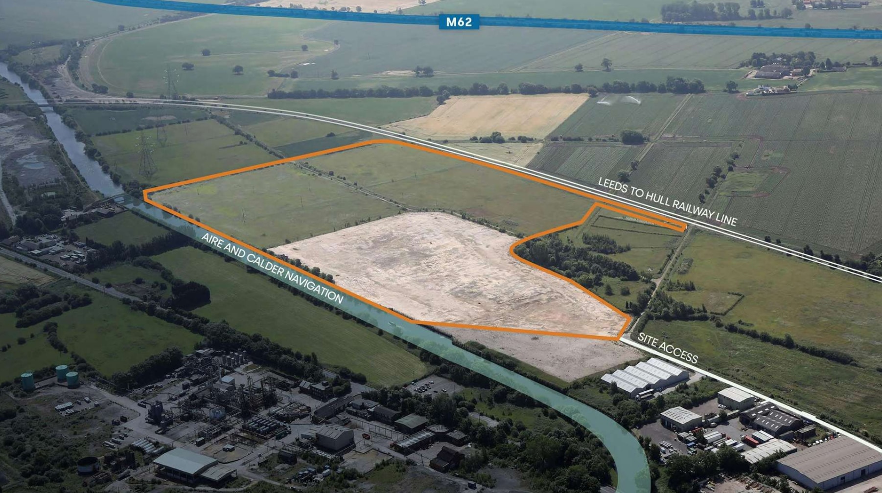
The site is made up of two main areas which are the former chemical works (7.5 hectares approximately) and the greenfield area to the east and south (13.96 hectares approximately). The site is fairly level with a maximum fall of approximately 1 metre across the site, the highest point on the former chemical works.
The Aire and Calder Navigation flows along the northern boundary of the wider site. To the east of the property is agricultural land and running along the southern boundary of the property and the wider site is a railway line. The land to the west of the subject property and comprising the western section of the wider site (where residential development is proposed) currently comprises agricultural/ grazing land, and beyond is a residential area.
FOR SALE DETAILS
PRICE
Request Info for Price
# OF LOTS
-
LAND DETAILS
PROPERTY TYPE
Land
PROPERTY SUBTYPE
Commercial
LAND PROPOSED USE
-
LAND ACRES
53 AC
LAND SF
2,308,680 SF
OFFSITE IMPROVEMENTS
-
ZONING
-
APN/PARCEL ID
WYK698908
ASK ABOUT THIS PROPERTY
Please correct the highlighted field(s).

By clicking the button, you agree to Showcase's Terms of Use and Privacy Policy.
Please correct the highlighted field(s).
By clicking the button, you agree to Showcase's Terms of Use and Privacy Policy.
