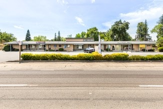
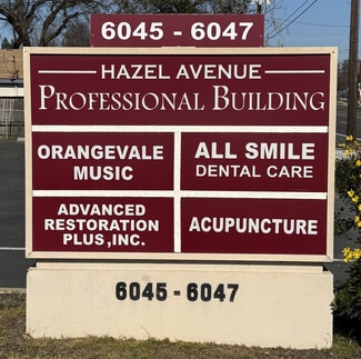
6045-6047 Hazel Ave - Office For Rent
Orangevale, CA 95662- Outer Folsom/Orangevale/Fair Oaks | 500-1,024 SF

916-813-5070
6045-6047 Hazel Ave
Orangevale, CA 95662
Outer Folsom/Orangevale/Fair Oaks
HIGHLIGHTS
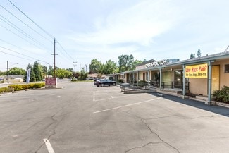
- Building and monument signage is available – a rarity for this type of space!
- Central Orangevale/Fair Oaks location with quick access to Hwy 50 freeway
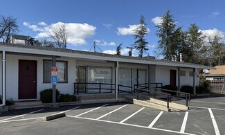
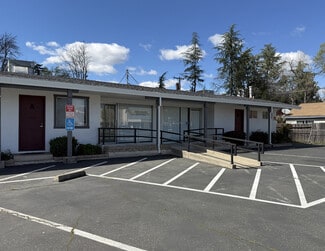
- Well-maintained BP (Business Professional) zoned property with functional suite layouts.
- Plenty of on-site parking plus available side street parking
- Very high traffic counts of over 40,000 ADT
- Restaurants nearby include Hot Off The Griddle, Mtn Mike’s Pizza, Blue Nami Sushi, Dave’s Hot Chicken, Bento Box, Jersey Mikes, Starbucks, and more.
OVERVIEW
Orangevale is a census-designated place (CDP) in Sacramento County, California, United States. It is part of the Sacramento metropolitan area. The population was 35,569 at the 2020 census, up from
33,960 at the 2010 census. It is located approximately 25 miles (40
km) northeast of Sacramento. The community is known for its rolling
hills that offer the best views of the Sierra Nevada mountain range,
its foothills, and a rural environment in the middle of a growing metropolitan area. Some residential properties in the area are zoned to
accommodate horses and orchards. It has a ZIP Code of 95662.
Originally Orange Vale Colony, the community began as part of the
1844 Rancho San Juan Mexican land grant. The area was rural and
home to numerous orange groves. Oak trees (remnants of which can
be seen in the Orangevale Park) were common, as were trails made
by Maidu Native Americans many years before. In addition to orange
groves, several olive orchards were also once in the area, and some
original trees can still be found along Chestnut, Orangevale, Main,
and Walnut Avenues
RENTAL DETAILS
SPACE AVAILABLE
500-1,024 SF
# OF SPACES
2
RENT RATE (MO)
$1.79-$2.00 USD /SF/mo
RENT RATE (YR)
$21.48-$24.00 USD /SF/yr
LEASE TYPE
Modified Gross
LEASE LENGTH
1-10 Years
AVAILABLE
Now
BUILDING DETAILS
PROPERTY TYPE
Office
PROPERTY SUBTYPE
Medical
TOTAL BUILDING SIZE
4,000 SF
BUILDING CLASS
B
YEAR BUILT
1960
PARKING SPACES
-
LAND DETAILS
LAND ACRES
0.33 AC
LAND SF
14,374.8 SF
ZONING
BP
ASK ABOUT THIS PROPERTY
Please correct the highlighted field(s).

916-813-5070
By clicking the button, you agree to Showcase's Terms of Use and Privacy Notice.
Please correct the highlighted field(s).
916-813-5070
By clicking the button, you agree to Showcase's Terms of Use and Privacy Notice.