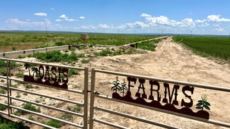
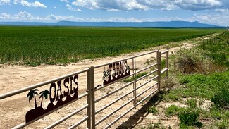
48999 County Road 48 - Agricultural LAND FOR SALE
Model, CO 81059 | 476,397,425 SF
$20,000,000 USD

830-308-7131
48999 County Road 48
Model, CO 81059
OVERVIEW
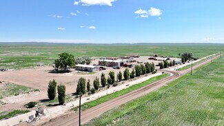
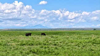
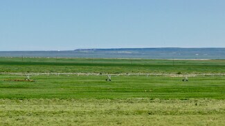
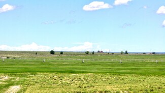
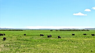
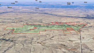
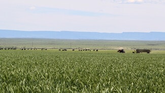
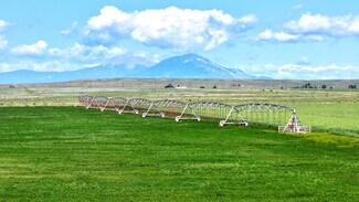
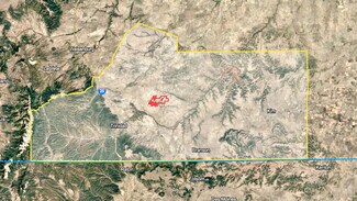
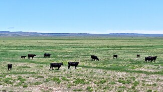
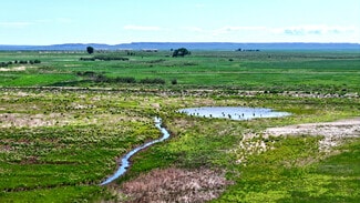
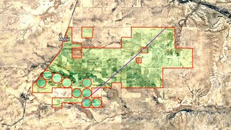
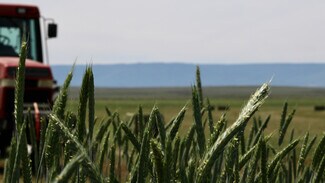
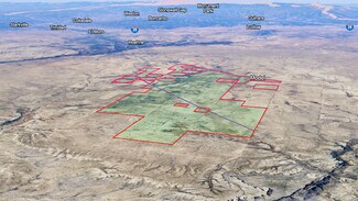
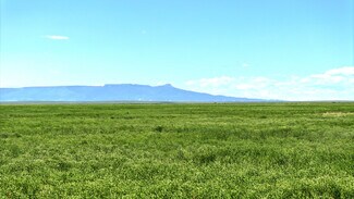
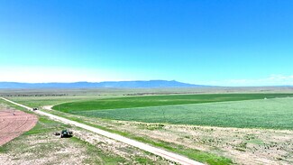
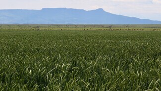
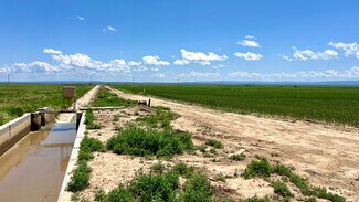
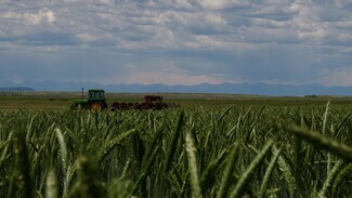
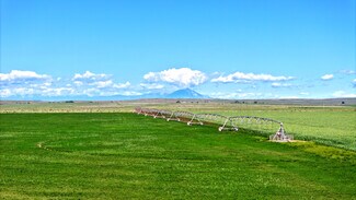
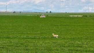
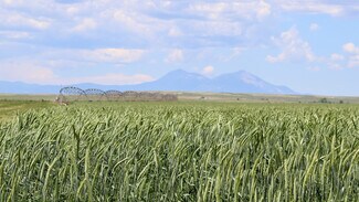
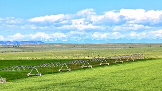
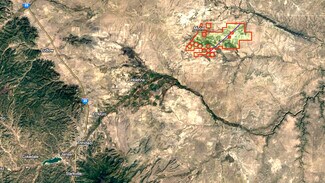
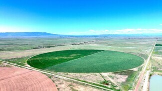
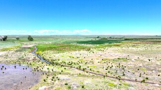
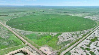
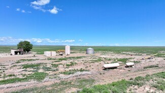
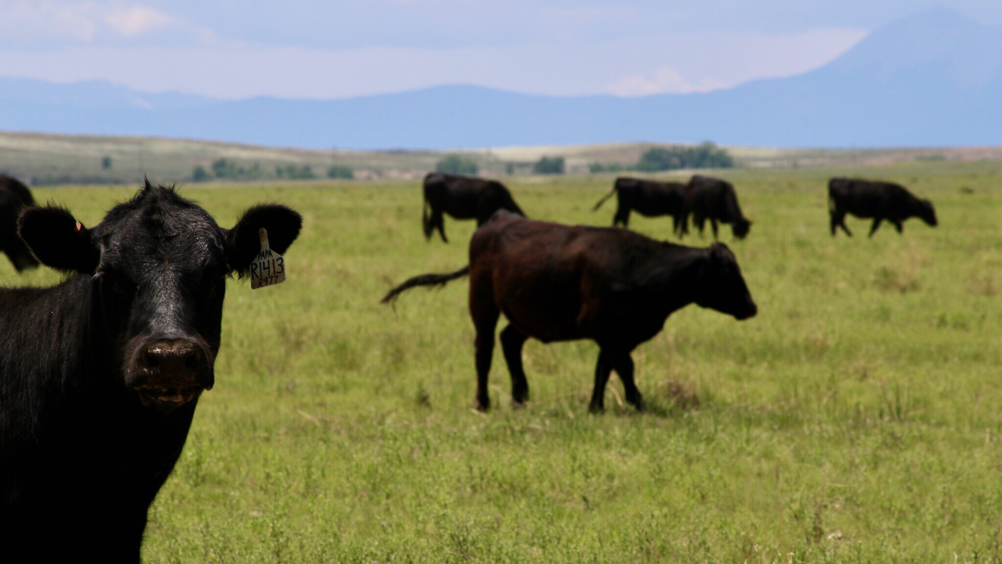
Oasis Farms consists of 10,936.58 total acres of rural agricultural irrigated farmland & native pastureland, with structural and irrigation improvements consisting of flood irrigated and center-pivot irrigated farmland.
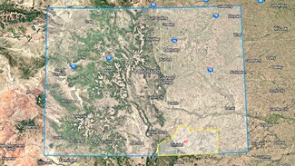
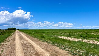
Location: 48999 CR 48, Model, Colorado. Approximately sixteen (16) to twenty-four (24) miles northeast of Trinidad, along the east side of US Highway 350, and both sides of (dirt/caliche) County Roads 48, 50, 52, 101, 105, & 107, in the central portion of Las Animas County, Colorado. Las Animas County, Colorado is currently designated as a Qualified Opportunity Zone.
Legal Description Summary: Various Sections throughout Township 31 South, Range 60 West; & Township 31 South, Range 61 West; 6th P.M., Las Animas County, Colorado. (Complete and accurate legal description is pending title examination).
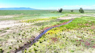
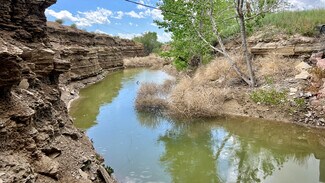
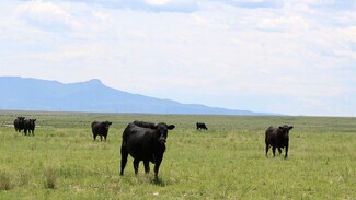
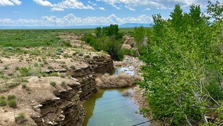
Land Information: Size 10,936.58 total acres, of which approximately 4,947.84 acres (46%) are ‘irrigable’ under flood irrigation or center-pivot irrigation, with the remainder in native pastureland, improvement sites, & roads. The subject property is considered to be irregular in shape with mostly level to slightly rolling topography. Blackwell Arroyo traverses the southwestern portion of the property.
Access: Property is accessed along the east side of US Highway 350, and both sides of (dirt/caliche) County Roads 48, 50, 52, 101, 105, & 107.
Zoning: Agricultural Zoning District - Las Animas County.
Flood Zone: According to FEMA FIRM Panel No. 08071C1400C, dated August 28, 2019, the subject property does not appear to be located in a flood hazard area. The drainage of the subject appeared to be adequate for use as agricultural land.
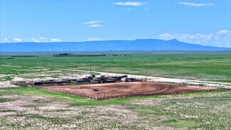
Mineral Activity: None.
Improvements:
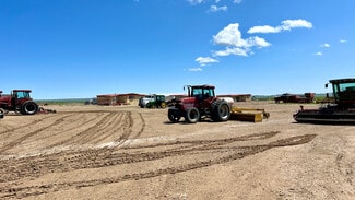
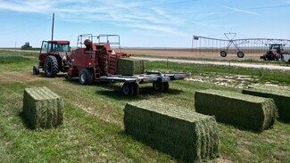
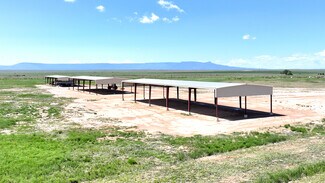
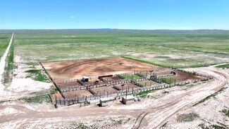
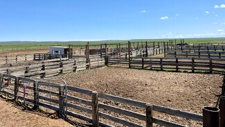
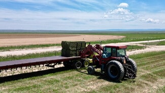
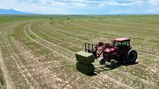
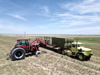
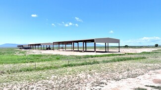
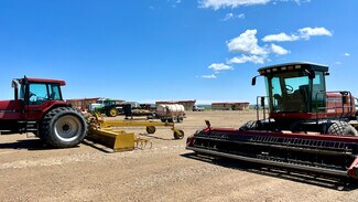
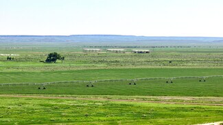
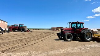
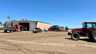
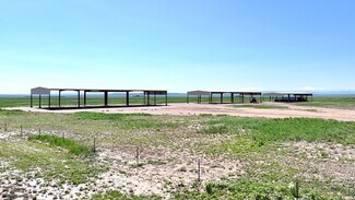
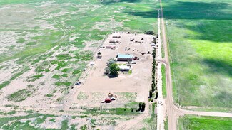
Structural: Structural improvements located at the headquarters of the property include a 1,276 SF modular home in good condition, three - 672 SF modular homes, and a 2,800 SF steel-frame shop. Additional improvements include a 1,980 SF modular home in good condition located just east of US Highway 350, and three - 7,500 SF steel-frame hay barns constructed in 2018 located just southwest of the headquarters.
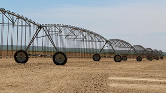
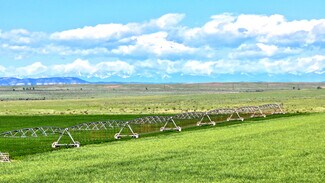
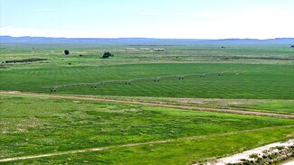
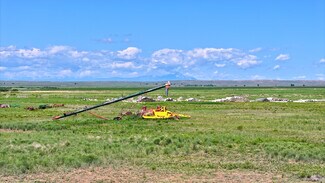
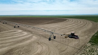
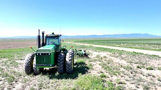
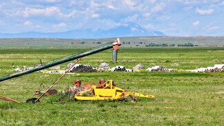
Irrigation: Irrigation improvements include one - 2021 model ¼ -mile Zimmatic center-pivot system, six - 2020 model ¼ mile Zimmatic center pivot and two 2022 model ¼ mile Valley center-pivot systems.
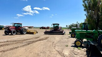
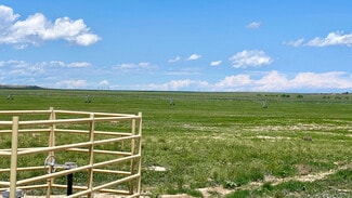
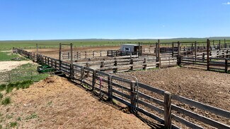
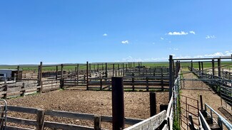
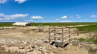
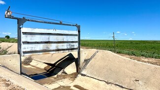
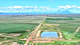
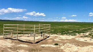
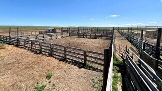
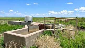
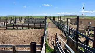
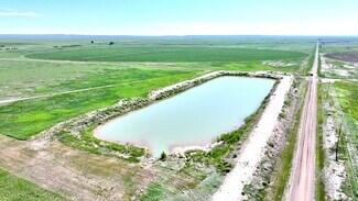
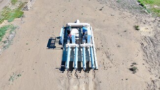
Site: Site improvements include a large set of wooden livestock working pens, numerous miles of concrete & dirt Model Irrigation Co. irrigation ditch, 3 70-HP VFD centrifugal water pumps, 30 miles of relatively new barb-wire fencing, 5 livestock water wells, 17 livestock water
drinkers, numerous miles of underground irrigation lines, gates, pumps, etc.
Utilities: Electricity, natural gas.
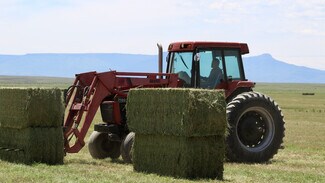
Current Use: Agricultural land as flood/pivot irrigated farmland.
Easements, Restrictions, and Encroachments: Typical utility easements are assumed to exist on the property. Additionally a natural gas pipeline right of way transects the property from the southwest to the northeast.
Soils: Data from the USDA Natural Resources Conservation Service Soil Survey. The soils are listed in order of predominance on the subject property:
Code Soil Description Capacity % of Subject Code
WrB Wilid silty clay loam 1 to 3% slopes 23.20% 6c
WyB Wilid silt loam 0 to 3% slopes 14.70% 4c
MzA Manzanola silty clay loam 0 to 2% slopes 13.60% 4c
Wilid Series- The Wilid series consists of very deep, well drained soils that formed in loess. Wilid soils are on plains and interfluves in MLRA 69. Slopes range from 0 to 12 percent. The mean annual precipitation is about 305 millimeters (12 inches). The mean annual temperature is about 11 degrees C (52 degrees F). These soils are rangeland or nonirrigated cropland. Native vegetation is mainly blue grama, galleta, sand dropseed, and western wheatgrass. It is correlated to the Loamy Ecological Site Description. Well drained; low or medium runoff; moderately high to high hydraulic conductivity.
*Source: USDA-NRCS Official Soil Series Descriptions -
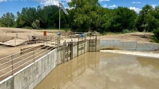
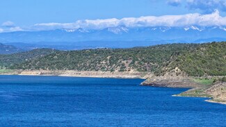
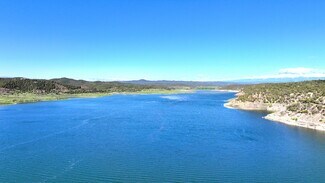
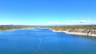
Irrigation Water: Oasis Farms, LLC contains a total of 5,965.9 shares of the Model Land & Irrigation Company, out of a total of 5,967.9 shares, equal to 99.97% of the company. The subject is the only farm which uses water from this system, and approximately 80% of the Model ditch is owned and operated by the subject property.
Additionally, these water rights equate to approximately 1/3 of the water held in the Trinidad
Reservoir Dam.
The water rights were originally decreed at 6,177 acres in 1925, and were appropriated in 1908 for 200 cfs from the Purgatoire River.
Over time, portions of the water rights have been vacated, leaving a current total of 4,947.84 acres of irrigation water rights. The water rights are administered through the Purgatoire River Water Conservation District.
Furthermore, diversions from the Purgatoire River into the Model Ditch vary greatly on an annual basis due to the amount of mountain rains and snow melt in the mountains west of Trinidad in the Purgatoire River watershed. As such, the previously mentioned storage rights located at the Trinidad Reservoir Dam become extremely beneficial.
Over the past 10 years, annual water diversions range from 236.4 acre feet to 20,464.6 acre feet, with an average of 5,092.67 acre feet. This average calculates to approximately
1.03 AF per acre for the 4,947.84 acres of water rights associated with the subject property.
The property contains significant infrastructure which catches and recycles remaining irrigation water after flood application. This infrastructure includes a series of ditches, canals, storage reservoirs, and water pumps strategically located throughout the property, and provides the ability to catch unused flood irrigation water and transfer it to various portions of the property for additional irrigation use. This has somewhat of a multiplying effect on the annual water diversions applied to the property.
The information contained herein has been gathered from sources deemed reliable; however, Legacy Broker Group and its principals, members, officers, associates, agents and employees cannot guarantee the accuracy of such information. The information contained herein is subject to changes, errors, omissions, prior sale, withdrawal of property from the market without prior notice, and approval of purchase by owner. Prospective buyers should verify all information to their satisfaction. No representation is made as to the possible value of this investment or type of use, and prospective buyers are urged to consult with their tax and legal advisors before making a final determination.
FOR SALE DETAILS
PRICE
$20,000,000 USD
PRICE/ACRE
$1,829/AC
PRICE/SF
$0.042 USD /SF
# OF LOTS
-
LAND DETAILS
PROPERTY NAME
Oasis Farms
PROPERTY TYPE
Land
PROPERTY SUBTYPE
Agricultural
LAND PROPOSED USE
Agricultural, Agribusiness, Pasture/Ranch
LAND ACRES
10936.58 AC
LAND SF
476,397,425 SF
OFFSITE IMPROVEMENTS
-
ZONING
-
APN/PARCEL ID
-
ASK ABOUT THIS PROPERTY
Please correct the highlighted field(s).

830-308-7131
By clicking the button, you agree to Showcase's Terms of Use and Privacy Policy.
Please correct the highlighted field(s).
830-308-7131
By clicking the button, you agree to Showcase's Terms of Use and Privacy Policy.