2872 Suncoast blvd - Commercial LAND FOR SALE
Homosassa, FL 34448 | 2,144,459 SF
$1,171,850 USD

352-400-2635

2872 Suncoast blvd
Homosassa, FL 34448
OVERVIEW
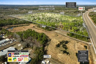
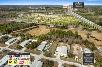
49.23± Acres | US Hwy 19/98 Frontage Mixed Use Development Opportunity
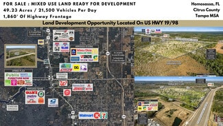
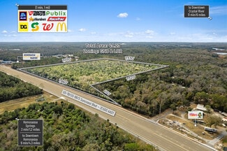
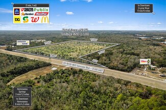
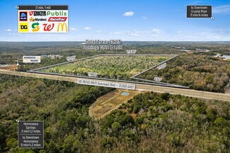
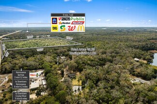
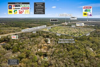
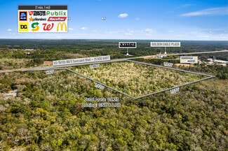
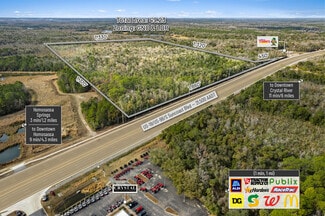
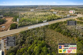
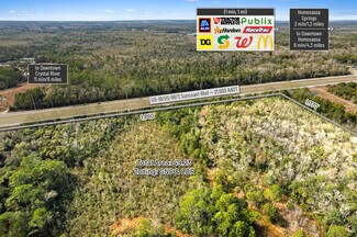
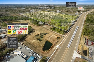
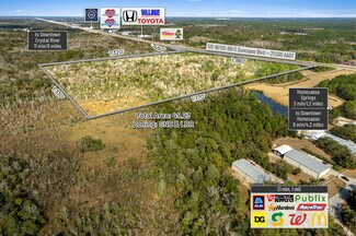
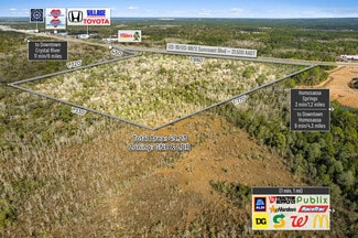
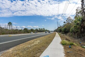
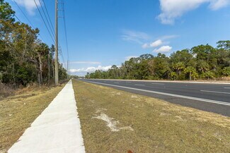
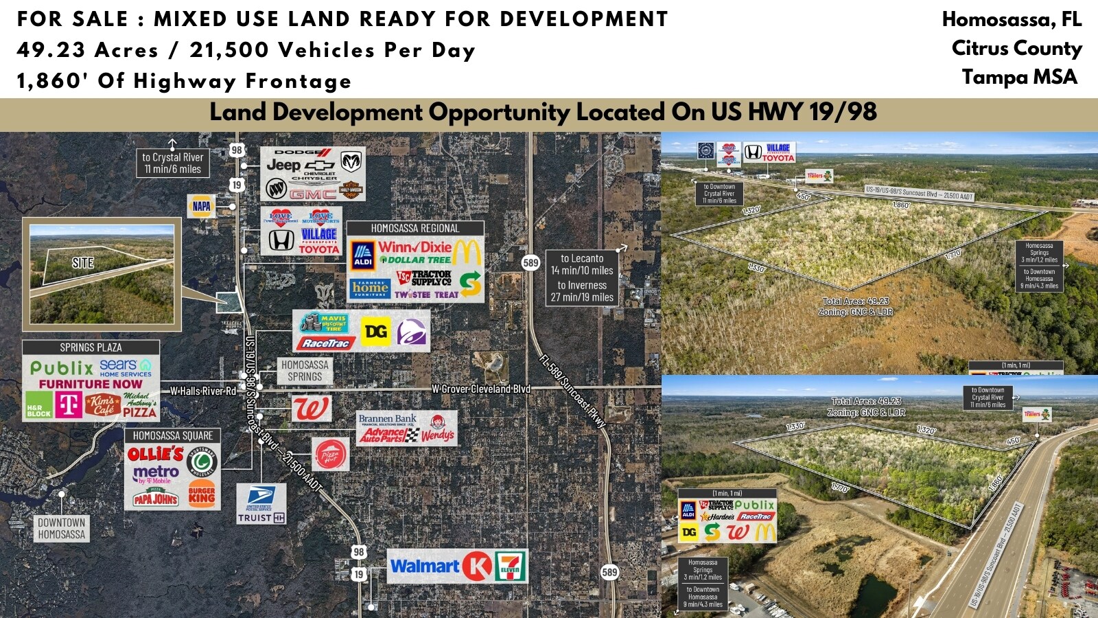
Positioned along busy US Hwy 19/98 in Homosassa, this 49.23± acre development opportunity offers over 1,800 feet of highway frontage and exposure to approximately 21,500 vehicles per day, delivering exceptional visibility and access within one of Citrus County’s most active commercial corridors. The property features a flexible mixed-zoning configuration suited for phased development and long-term value creation.
Approximately 8.72± acres are zoned General Neighborhood Commercial (GNC), permitting a wide range of uses including retail, medical and professional office, automotive sales and service, restaurants, and service-oriented businesses, with multifamily development possible at up to 10 units per acre through a Planned Unit Development (PUD) and utility connections meeting Land Development Code requirements.
The remaining 40.51± acres are zoned LDR (Low Density Residential), allowing a base density of two dwelling units per acre with the potential to increase density up to six units per acre through a PUD. Permitted residential configurations include single-family, duplex, and attached housing, while conditional uses may include assisted living facilities, nursing homes, and certain recreational uses subject to approval.
Based on available GIS mapping and environmental data, the parcel is generally characterized as approximately 4.93 acres of GNC commercial uplands, 3.84 acres of GNC wetlands, 34.74 acres of LDR uplands, and 5.77 acres of LDR wetlands. Using the upland residential acreage of 34.74 acres, the site could support an estimated 69 dwelling units at the base density of two units per acre, approximately 139 units at a realistic planning yield of four units per acre, or up to 208 units at the maximum six units per acre with PUD approval and compliance with infrastructure and utility requirements.
The 4.93 acres of commercial uplands provide capacity for approximately 43,000 to 64,000 square feet of neighborhood retail, medical, or service-oriented commercial development depending on site design and coverage ratios. If wetland areas are mitigated and deemed developable, additional density may be achievable; however, all density figures are planning estimates only and subject to formal wetland delineation, engineering analysis, mitigation requirements, and jurisdictional approvals.
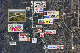
The site is located within an established retail node supported by national grocers, retailers, quick-service restaurants, fuel stations, and service providers that create consistent consumer draw and sustained commercial demand. Regional connectivity is enhanced by direct access to US Hwy 19/98 and proximity to the expanded Suncoast Parkway (SR 589), a $135 million state infrastructure investment that improves regional mobility and places the property within approximately 55 minutes of Tampa International Airport. The planned northern Phase 3 extension, located just north of the property, is expected to further increase accessibility, tourism flow, and residential demand throughout the corridor.
From a market perspective, the property benefits from its location within Citrus County, a region experiencing steady population growth and increasing commercial demand. The county currently supports a population of approximately 153,600 residents, with long-term planning capacity for approximately 350,000 residents under the county’s Land Development Code. Continued residential expansion, infrastructure investment, and regional economic development are driving increased demand for healthcare, service, and retail facilities throughout the county. Within a 15-minute trade area, the site serves approximately 46,361 residents, supported by stable demographics including an average age of 58 and a median household income near $65,000. The convergence of population growth, expanding infrastructure, and interchange-supported accessibility positions this property as a high-visibility, scalable, and future-oriented development opportunity within one of Florida’s advancing growth corridors.
Logistic Details:
County Road 486 runs entirely along West Norvell Bryant Highway. It runs West to East from SR 44 east of Crystal River into US-41 in Hernando, just south of the southern terminus of SR 200. The route was once the former SR 486. County Road 486 spans 4 lanes, is almost entirely a divided highway, and is flanked by a parallel bicycle path on the south side.
County Road 491 is Lecanto Highway, a bi-county South to North road that begins at the Hernando-Citrus County Line in Oak Grove near the Withlacoochee State Forest and ends at SR 200 in Stoke's Ferry, just south of the intersection with the northern segment of CR 39. It was formerly designated as SR 491.
County Road 486 runs entirely along West Norvell Bryant Highway. It runs West to East from SR 44 east of Crystal River into US-41 in Hernando, just south of the southern terminus of SR 200. The route was once the former SR 486. County Road 486 spans 4 lanes, is almost entirely a divided highway, and is flanked by a parallel bicycle path on the south side.
County Road 491 is Lecanto Highway, a bi-county south-to-north road that begins at the Hernando-Citrus County Line in Oak Grove near the Withlacoochee State Forest, and ends at SR 200 in Stoke's Ferry, just south of the intersection with the northern segment of CR 39.
County Road 44 (often marked as County Road 44W) exists as the western tip of old Florida State Road 44, south of "Downtown" Crystal River. The suffix "W" was most likely added to not confuse this section with State Road 44, to the north, and to show its location by being west of US 19 and US 98(SR 55). As with the majority of these types of 'coastal spur' routes, in West Central Florida, it is county-maintained.
U.S. Route 19 (US-19) runs 264 miles (425 km) along Florida's West Coast from an interchange with U.S. Route 41 in Memphis, Florida, south of Tampa, and continues to the Georgia border north of Monticello, Florida. Newly 6 lane Highway was constructed from the Hernando County line to Fort Island Trail and US 19 in Crystal River, Florida.
Suncoast Parkway:
The Suncoast Parkway recently opened was a $135 Million Dollar expansion that extends 13 miles north from US-98 to SR 44 which features 15 new bridges, electronic tolling gantries, and the extension of The Suncoast Trail part of the Florida's Statewide Greenways and Trail System. The Suncoast Parkway is just 68 Miles 1 hour and 15 mins from Tampa making it a great commuting Highway for the workforce seeking to be outside of the Tampa traffic. The Veterans Expressway and Suncoast Parkway is a north–south toll road near the Florida Gulf Coast. Maintained and operated by Florida's Turnpike Enterprise, this 68-mile transportation corridor extends from State Road 60 in Tampa, north to State Road 44 near Lecanto.
FOR SALE DETAILS
PRICE
$1,171,850 USD
PRICE/ACRE
$23,804/AC
PRICE/SF
$0.55 USD /SF
# OF LOTS
-
LAND DETAILS
PROPERTY NAME
49.23± Acres US Hwy 19/98 Frontage Mixed Use
PROPERTY TYPE
Land
PROPERTY SUBTYPE
Commercial
LAND PROPOSED USE
Commercial, Retail
LAND ACRES
49.23 AC
LAND SF
2,144,459 SF
OFFSITE IMPROVEMENTS
-
ZONING
GNC/LDR
APN/PARCEL ID
1121647,1121655
ASK ABOUT THIS PROPERTY
Please correct the highlighted field(s).

352-400-2635
By clicking the button, you agree to Showcase's Terms of Use and Privacy Notice.
Please correct the highlighted field(s).
352-400-2635
By clicking the button, you agree to Showcase's Terms of Use and Privacy Notice.