2500 Trout Creek Road (appx) - Commercial LAND FOR SALE
Wikieup, AZ 85360 | 27,486,360 SF
$750,000 USD

2500 Trout Creek Road (appx)
Wikieup, AZ 85360
OVERVIEW
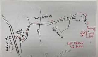
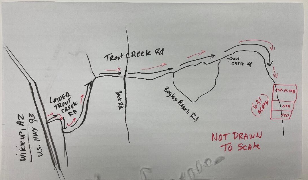
Cross Streets: US 93 and Lower Trout Creek Rd Directions: SEE DRIVING MAP in PHOTOS: North of the city of Wikieup, Take Lower Trout Creek Road East from US 93. It turns in to Trout Creek Rd. Stay on it until you reach any of the GPS Coordinates listed below. Signs up soon
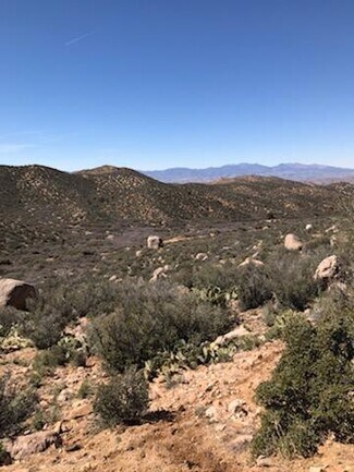
Public Remarks: 631 Acres of beautiful mountains, valleys, flat land....everything you would ever want in a secluded ranch away from it all but only minutes from the town of Wikieup and about one hour from Kingman! Plenty of State and Federal Trust land all around so bring your toys! Seller says depth for drilling a well is only about 250 feet! Trout Creek Road runs through all three parcels. See map pictures in the photos. GPS Coordinates: 252-01-019: Latitude 34.8971242038619 Longitude -113.485372525131........252-01-020: Latitude 34.8934551623909 Longitude -113.485327012347........252-01-018: Latitude 34.9025463222907 Longitude -113.485282666322
FOR SALE DETAILS
PRICE
$750,000 USD
PRICE/ACRE
$1,189/AC
PRICE/SF
$0.027 USD /SF
# OF LOTS
-
LAND DETAILS
PROPERTY NAME
631 AC, Wikieup, AZ + 10 Acres Mineral Rights
PROPERTY TYPE
Land
PROPERTY SUBTYPE
Commercial
LAND PROPOSED USE
-
LAND ACRES
631 AC
LAND SF
27,486,360 SF
OFFSITE IMPROVEMENTS
-
ZONING
-
APN/PARCEL ID
252-01-018,252-01-019,252-01-020
ASK ABOUT THIS PROPERTY
Please correct the highlighted field(s).

By clicking the button, you agree to Showcase's Terms of Use and Privacy Notice.
Please correct the highlighted field(s).
By clicking the button, you agree to Showcase's Terms of Use and Privacy Notice.