512-773-3705
11812 Windy Ridge Rd
Austin, TX 78726
Grandview Hills
OVERVIEW
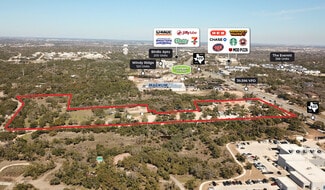
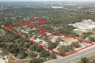
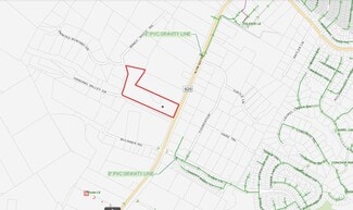
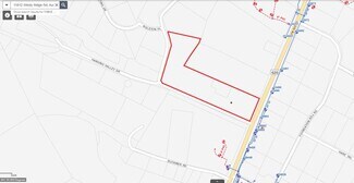
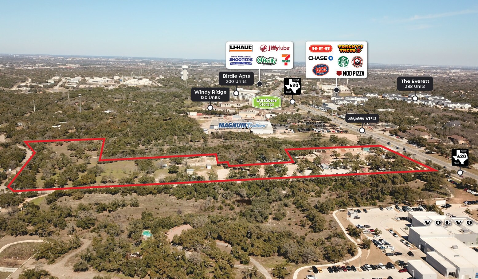
The 13.78-acre site is located at the corner of RR 620 and Windy Ridge Road, featuring approximately 350 feet of frontage on RR 620 and 1,350 feet on Windy Ridge Road. The site is subject to zoning classifications GR-CO and RR, with zoning case C14-02-0154 and ordinances 050127-59 and 860109-C governing its use. It falls within the Hill Country Roadways Overlay (Moderate Intensity) and Scenic Roadways Overlay (RM 620). This is one of very few over 5 AC tracts available fronting on FM 620 for development between Anderson Mill and Mansfield Dam.
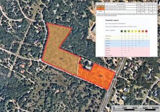
While there is no Future Land Use Map (FLUM) or Regulating Plan, the site is located within 1.5 miles of a Wildland Area per the Wildland Urban Interface classification. There are no designated infill options, neighborhood restricted parking areas, mobile food vendor zones, or historic landmarks.
From an environmental perspective, the site is not within a FEMA or fully developed floodplain but does fall within the Lake Travis Watershed and the Edwards Aquifer Recharge Zone (North). Water supply to the area is designated as rural.
Tenants are responsible for all utilities, maintenance, and insurance and receive free water from the existing property well. The landlord pays taxes.
For official zoning verification and development guidance, consultation with the Land Development Information Services or a Zoning Verification Letter is recommended.
FOR SALE DETAILS
PRICE
Request Info for Price
# OF LOTS
-
LAND DETAILS
PROPERTY NAME
RR 620 and Windy Ridge
PROPERTY TYPE
Land
PROPERTY SUBTYPE
Commercial
LAND PROPOSED USE
Multi-Family
LAND ACRES
13.78 AC
LAND SF
600,257 SF
OFFSITE IMPROVEMENTS
-
ZONING
GR-CO, RR
APN/PARCEL ID
-
ASK ABOUT THIS PROPERTY
Please correct the highlighted field(s).

512-773-3705
By clicking the button, you agree to Showcase's Terms of Use and Privacy Notice.
Please correct the highlighted field(s).
512-773-3705
By clicking the button, you agree to Showcase's Terms of Use and Privacy Notice.